We remain fully operational. Our teams are working around the clock to ensure your deliveries continue safely.

DOWNLOAD THE APP


Customer Services
Copyright © 2025 Desertcart Holdings Limited
DOWNLOAD THE APP


Buy anything from 5,000+ international stores. One checkout price. No surprise fees. Join 2M+ shoppers on Desertcart.
Desertcart purchases this item on your behalf and handles shipping, customs, and support to Cyprus.
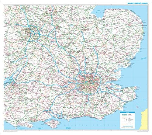
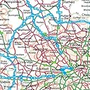
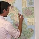
Specially produced for the commercial driver and practical motorist, designed for planning of sales and transportation within a 100 mile radius of London. Fully updated for 2010, roads are colour-coded for easy use, road numbers and distances are shown in a format that is clear and easy to read. Also includes county boundaries, airports and ferry routes. The area covered is from Bristol to the East coast and from Stoke-on-Trent to the South coast. Size: 90 x 105 cm (36 x 42 inches). Scale: 1:316 800 (5 miles to 1 inch) The map is permanently bonded between two sheets of tough, flexible, crystal-clear plastic. This finish allows you to "write on, wipe off" with dry or wet wipe pens. The map is also available framed in either superb satin-finish aluminium or dark or light wood supplied ready to display.
Trustpilot
1 day ago
1 month ago