

Rocky Mountain National Park
Product ID: 1607869
💧Waterproof durability
🧭Full UTM grid for GPS navigation
🗺️1:50,000 scale topographic detail
Desertcart purchases this item on your behalf and handles shipping, customs, and support to Cyprus.
🗺️ Unlock the wild with the ultimate Rocky Mountain trail companion!
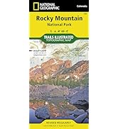
The National Geographic Trails Illustrated Map of Rocky Mountain National Park is a waterproof, tear-resistant topographic map printed at a 1:50,000 scale. It features over 400 miles of trails for multiple outdoor activities, detailed elevation contours, and a full UTM grid for GPS navigation. Developed with local agencies, this durable, foldable map is an essential tool for exploring the park’s diverse wilderness year-round.







| Best Sellers Rank | #34,694 in Books ( See Top 100 in Books ) #35 in West Mountain United States Travel Books #59 in Hiking & Camping Excursion Guides (Books) #62 in United States Atlases & Maps (Books) |
| Customer Reviews | 4.8 out of 5 stars 762 Reviews |
L**O
A Useful Guide
This is a very useful book if you plan to spend time in RMNP.
C**L
I love Trails Illustrated maps
I've always loved Trails Illustrated maps for their topographical lines, accuracy and good detail and this one is no different. Their maps stand out because they are foldable, but they have that coating that makes them more durable than regular paper maps and if they get water on them they're not ruined. There are a ton of trails in Rocky Mountain National Park and many of them dissect each other so it's important to have an accurate map that shows all the trail characteristics and scale of distances. Great map!
T**N
A wonderful strong detailed map.
Great detailed plastic map. I have hiked many trails in RMNP and I wished I would have had this map. I love it and gave it to my grandson for this past Christmas. Stick in your pack and take it along as a guide no mater if it rains a bucket. Use it for planning your trips. It will get you to anywhere in the park if you are physically up to it.
D**N
Awesome Map!!!! This is a must-have for hiking in Rocky Mountain National Park.
I ordered this for our recent vacation in Rocky Mountain National Park. We spent a week out there and did a few day hikes. We used the heck out of this map to help decide which trails we wanted to hike, and to figure out how to get to them. We also used various books for input on trail ratings and descriptions, but this map gives you the whole picture of where the trails are and what the terrain is like. While we were on the trail, this map was very useful in helping us figure out where we were at any given time. I wouldn't hit the trail without this in my pack.
L**.
Incredibly useful map
This map was absolutely essential for our backpacking trip this past summer. Even though it's waterproof and tearproof, we wanted to take care of it since we would like to use it for a long time, so we put it in a plastic map holder. The map holder was quite a bit smaller than the entire map, so we just folded it in a way that only the portion of the park we were in was visible. EVERYTHING we needed was on this map! Our backcountry campsites, all of the trails, elevation, etc. We did find, however, that what we thought was mileage was actually in kilometers (we think - there really was no key that I could find to figure out what the numbers on the trails meant...). This was absolutely essential for two individuals who were new to the park and hiking in some dangerous terrain. I don't think we would have been able to find our way without it, especially when we had to take a few detours due to the weather. About half of the trail we hiked was covered in snow, so it was difficult to find any trailmarkers.
F**K
Great backup
Always good to have a real map as a backup. Sometimes way out in the boonies you have no signal and a real map is your best friend.
J**1
Very Detailed
This is a VERY detailed and accurate trail map. Each trail section is marked with mileage. The name and location of each back country campsite and other amenities are clearly marked. It came in extremely handy for planning a trip to RMNP this coming August(2013). It's almost as though you're right there in the park. When I called for back country campsite reservations the Ranger was impressed with my knowledge of the area where I reserved considering I had never been there. When I told him I got the info from the Nat. Geo. map he immediately said "That's one of the best maps of the park there is." It's also very sturdy and has a water repelling coating to help it last longer. Looking forward to the trip and taking this map with me.
D**N
Really good map of RMNP.
This was laminated correctly. The map was the correct size and easy to use.
I**A
Very good
Must to have if you are going to visit the Rockies! National Geographic's products are always the best! Buy it!
C**N
Edición anterior a la anunciada
Se anuncia la revisión de 2012 pero llega la de 2008. De hecho las imágenes en la web no se corresponden con el producto recibido y en éstas el mapa corresponde a una edición con copyright de 2019
ザ**生
非常に見やすい
ロッキーマウンテン国立公園に行って、トレイルをいくつか回りまし。計画を立てるとき、実際にトレイルを歩くときにとても参考になりました。防水性もあり、使い易いことも利点です。
Trustpilot
1 month ago
2 months ago