

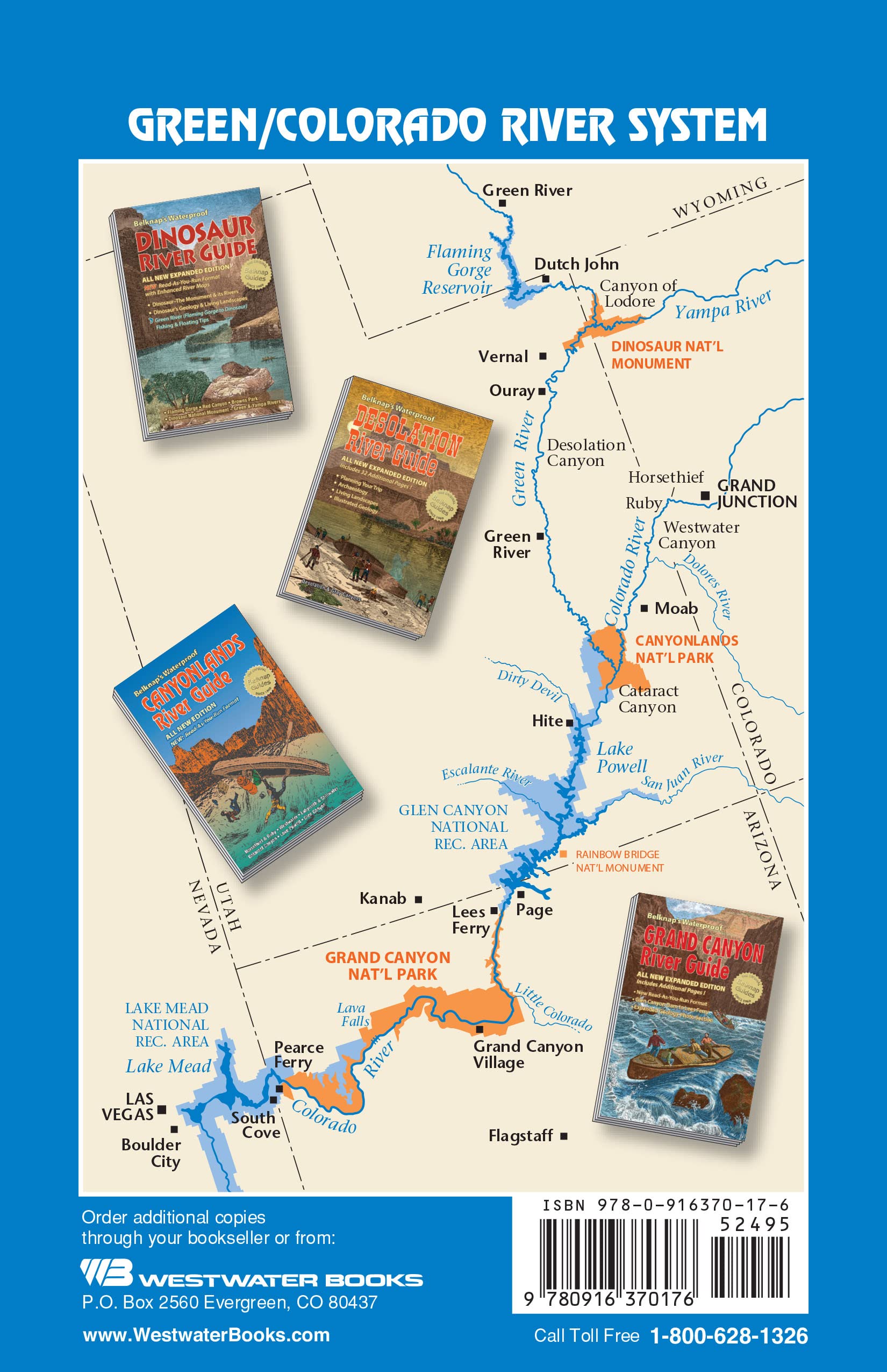
Belknap's Waterproof Canyonlands River Guide
R**Y
Great asset on the river, easy to navigate; get it!
Just came off a 5 day / 4 night trip from Mineral Bottom to the Confluence of the Green and Grand (Colorado). I felt I needed to leave this little book a review, as I hesitated purchasing it due to the Negative Nancy reviews I saw. But in reality, this little book was a great asset! We had this book and the Canyonlands Nat Geo map and used this far more. For those who complain that it's not detailed enough, doesn't have GPS coords, doesn't list hikes, etc - it's a river guide, not a hiking guide, not a Canyonlands guide. If you need GPS coords to read a map, perhaps you should rethink doing this float. Or leaving the house - it's scary out there! Just remember this - Powell et al. floated the Green/Grand in wooden boats laden with supplies and equipment and had no clue what was going to befall them, rapids and all, so buck up and stop whining about GPS. This book very clearly shows the river and river mileage, side canyons, and a few points of interest (ruins, cliff dwellings, etc). It doesn't show campsites, and rightly so as you can camp wherever the heck you can find dry flat ground - listing campsites would be silly as they come and go with river level (it was ~19,000 cfs on this trip and sites were sparse but we had no problem finding a site every night). In reality, it's up to you if you to figure out where you want to camp.For those who want more information on what to do or see while you're out there (or dare I say, where to camp?) I would highly recommend talking to a River Ranger. But seriously people, have a sense of adventure, pick some canyons, and go exploring! There are petroglyphs everywhere, slot canyons, dry waterfalls, and amazing hikes and sites along the entire stretch - go find them and use this RIVER guide to do it! It's like people don't know what to do if they haven't flown it with google earth, read about it in a million blogs and books, and looked at all the pictures on the internet. I mean come on people! Get this book, use it to orient yourself while you're on the river, plan you daily mileage, and pick what you want to see and go find some cool stuff! And if you need GPS coordinates to read a map, maybe you should consider not doing a self guided tour.My one suggestion for the next edition - Spanish Bottom is the takeout if you flatwater either the Green or Grand and a contiguous map to that point would be nice for both routes (repeating the info in the book for convenience). As it is, the maps stop just after the Confluence on both routes (i.e. it shows Green River to the Confluence and Moab to the Confluence - either way, the Confluence down to Powell is in the book so it's just a matter of flipping pages; not really that big of a deal.)
N**K
Accurate and essential... don't lose it !
Just returned from 11 days paddling the Green River by kayak and this guide is accurate and essential. I recommend drilling a hole in the upper corner and attaching a lanyard to your guide, because as I landed for the evening one afternoon I found my guide had fallen off my deck and into the water under my kayak. I pulled it up and true to the description it was waterproof and dried out the next day while paddling. Truly a great product that will tell you where you are on the river.
A**1
I would have loved more detail on the specifics of our area of ...
Just used this on our canoe trip through Stillwater Canyon. Very helpful. It appeared to be the one to have since almost all the canoers we saw on the river had this guide. I would have loved more detail on the specifics of our area of the river, but it was probably meant more as a general map/overview of a lot of areas and so couldn't go into too much detail on any one area. I'd use it again.
C**.
Fantastic
By far the best book and map on floating the Green and Colorado rivers. The maps are detailed and at a perfect scale. The paper and binding held up great despite being kicked around the bottom of the canoe for a week.I hesitated to buy it because of the corny cover, but the photos and information inside are professional grade, and it's well worth the money. In fact, I can't think of a single thing to improve it
M**O
Informative and easy to travel with
I bought this book for a rafting trip in the Grand Canyon. It is easy to pack, and I love how it is waterproof!
K**R
There are some annotations showing where some points of interest are and there is good, brief introductory info
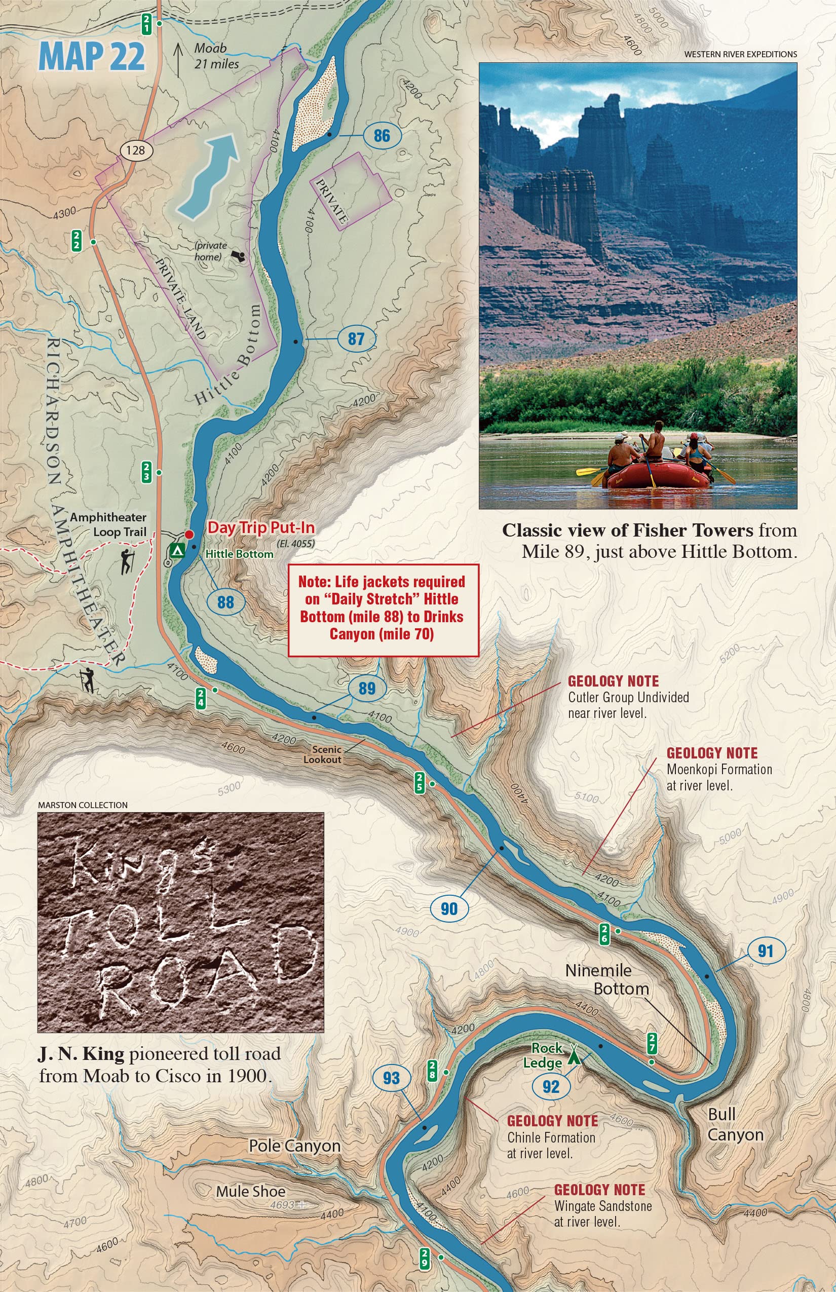
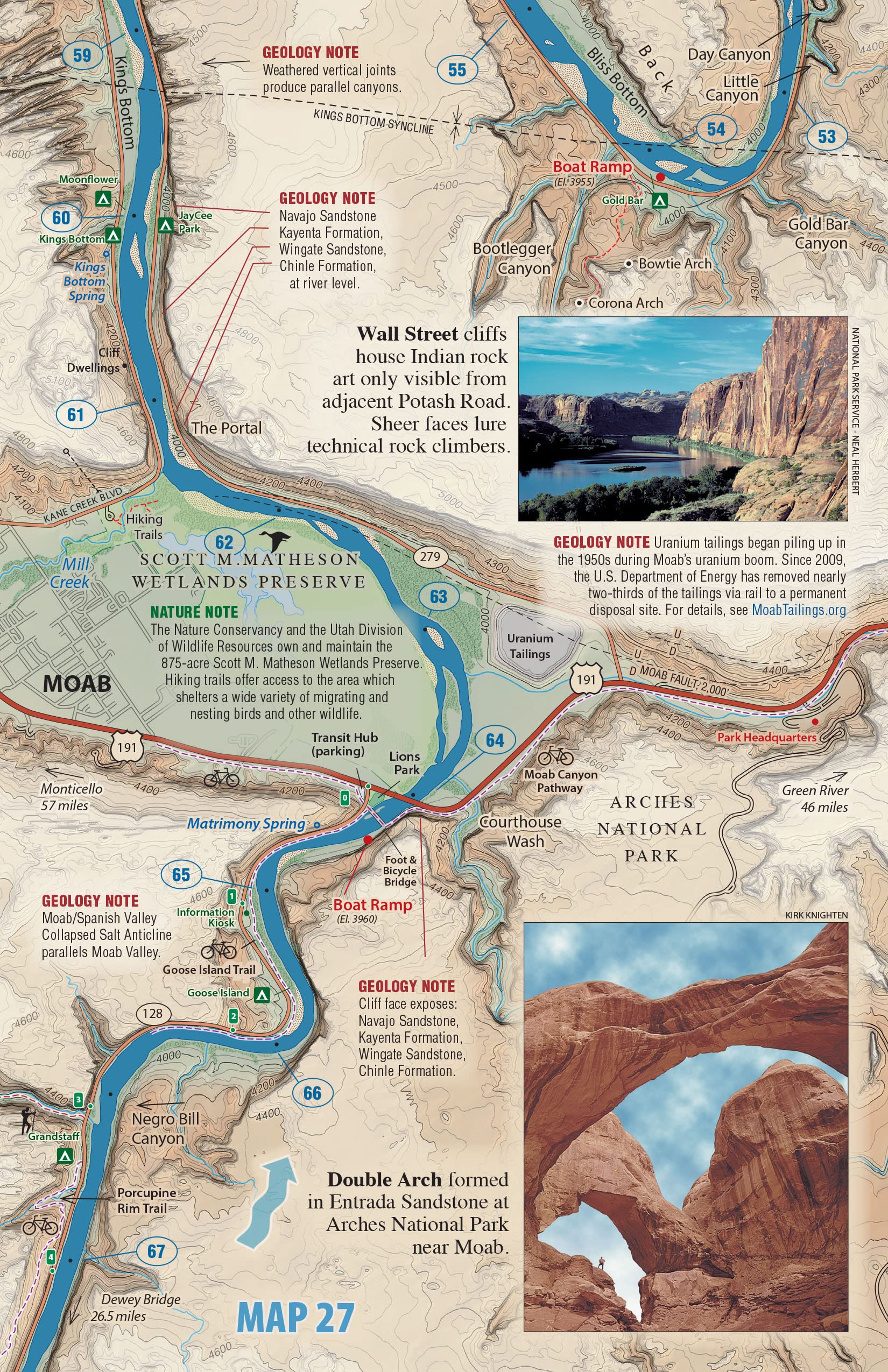
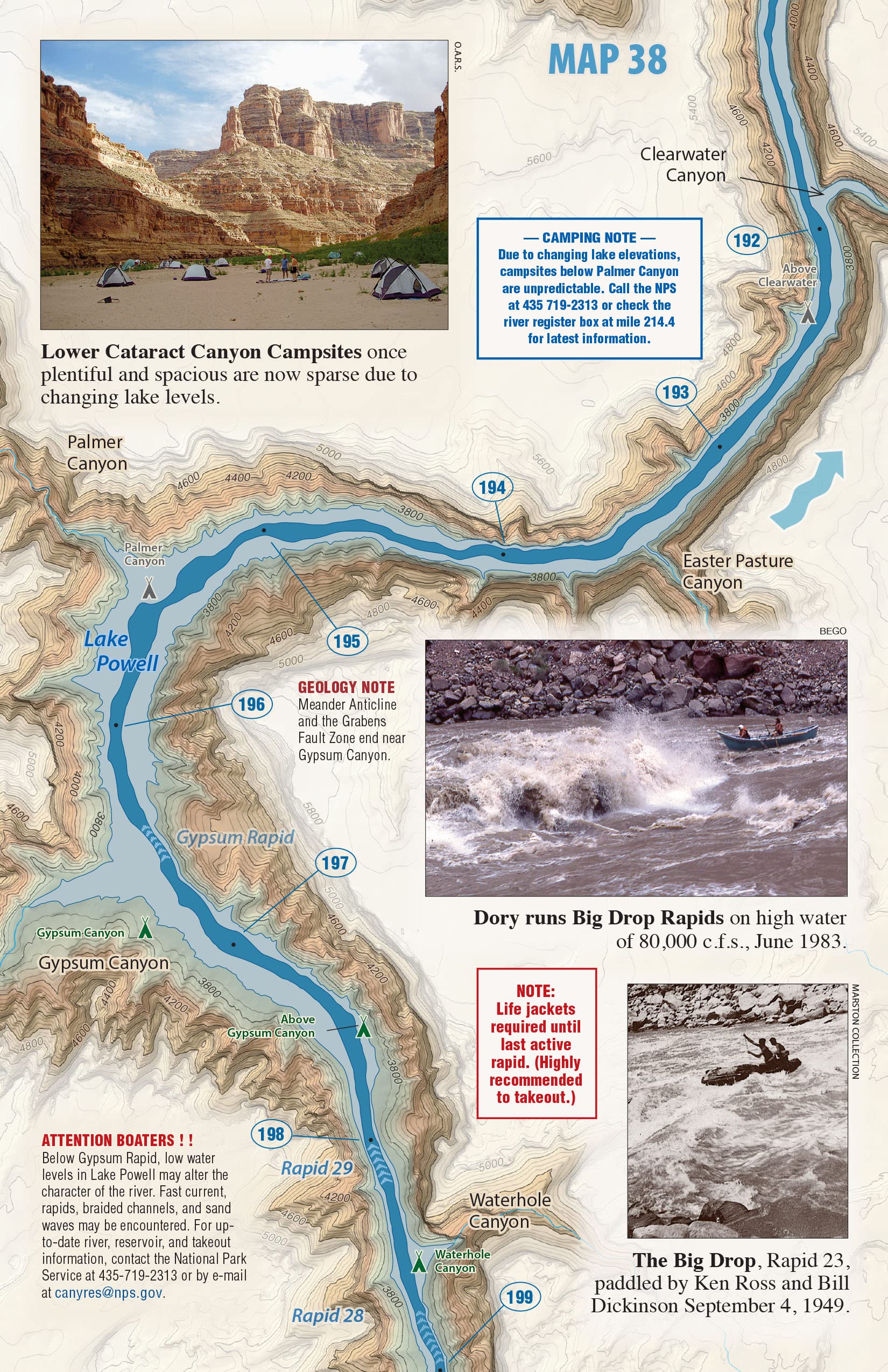
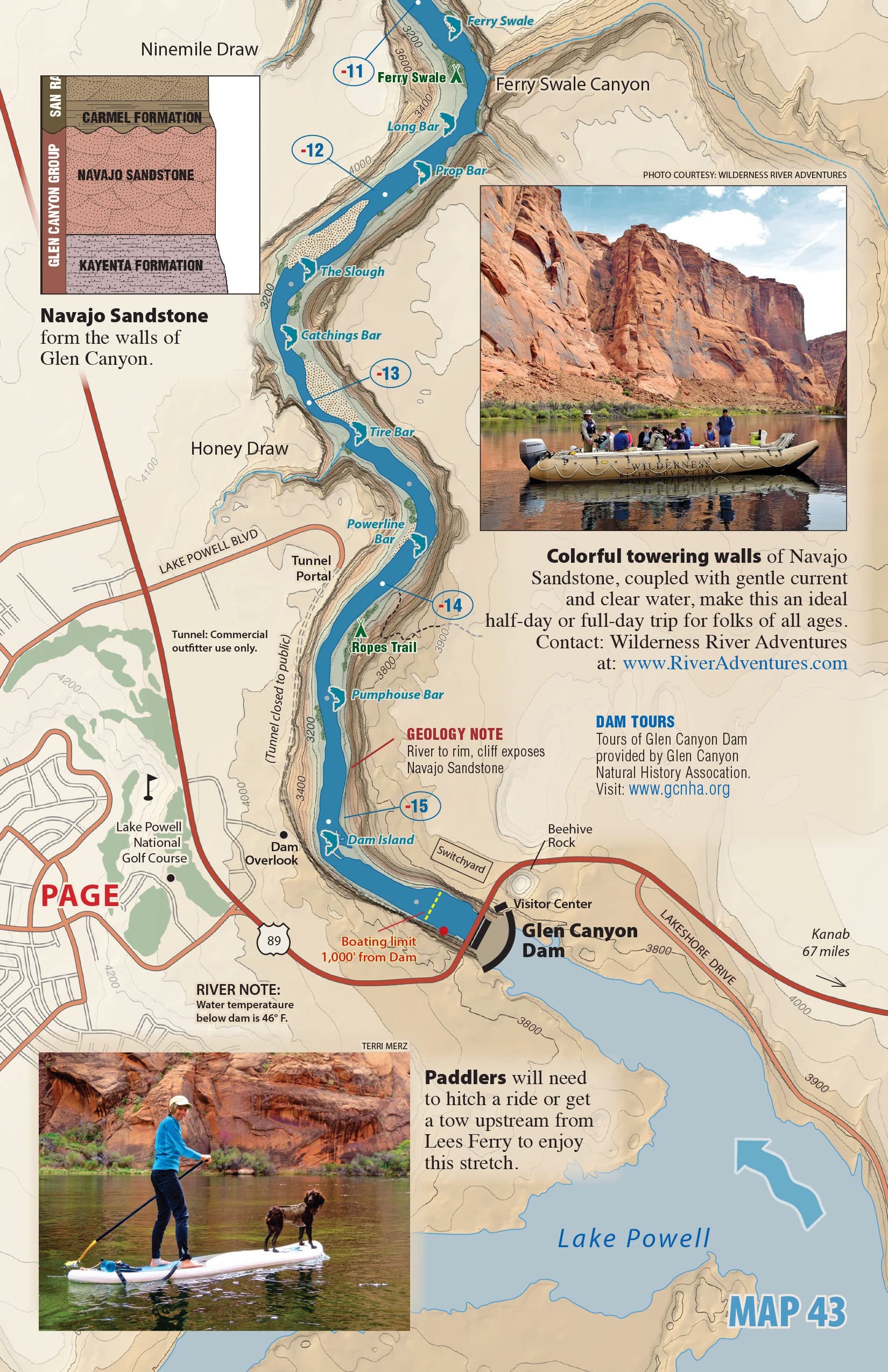
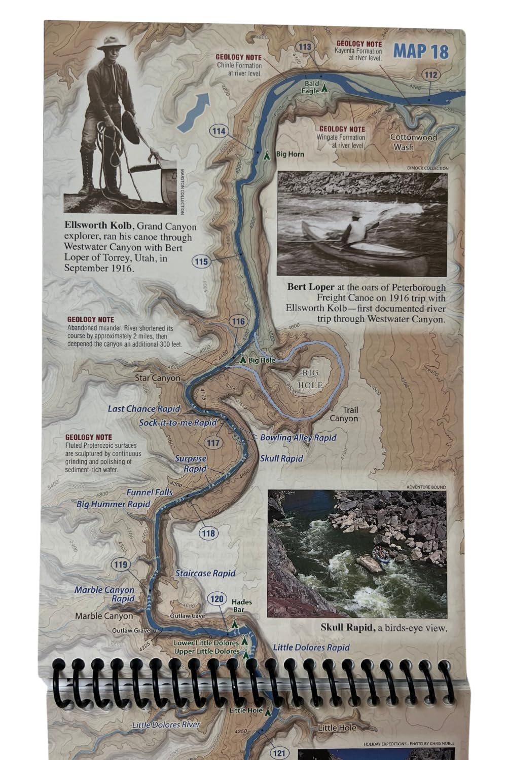
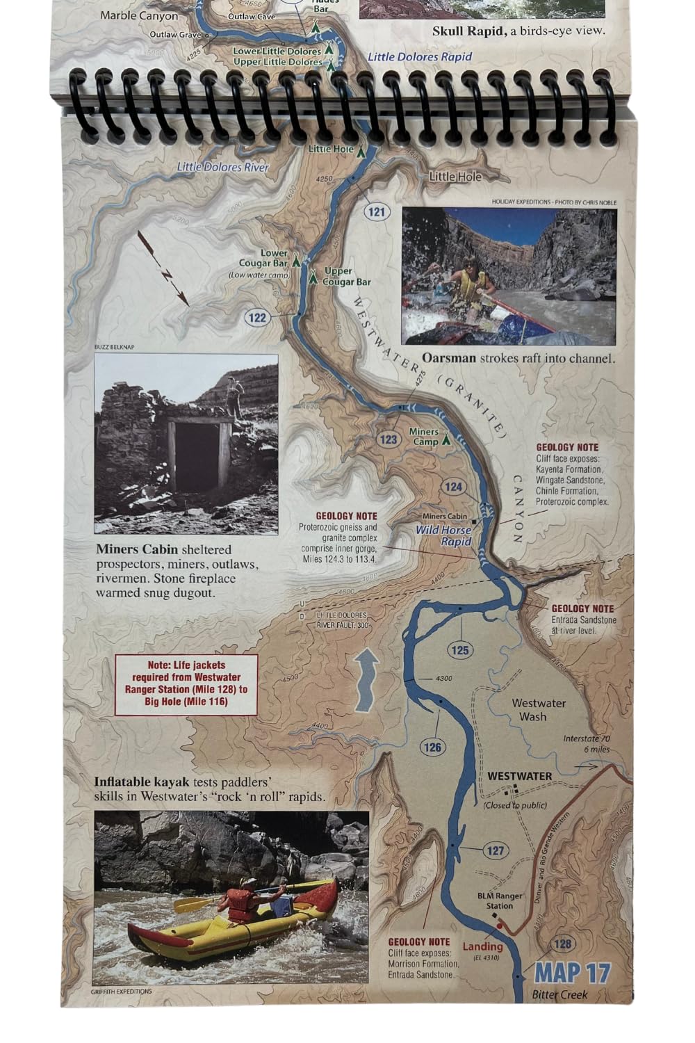
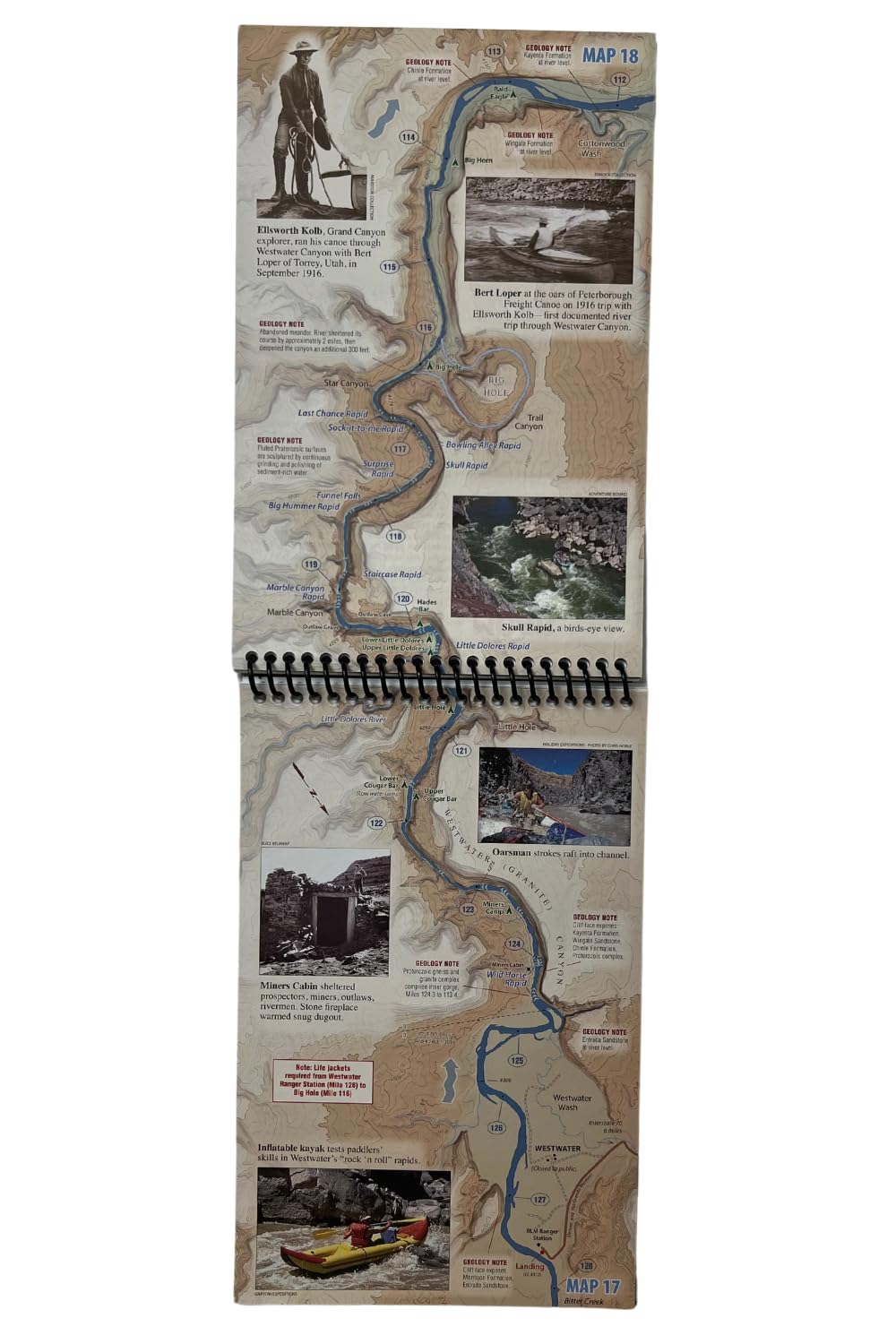
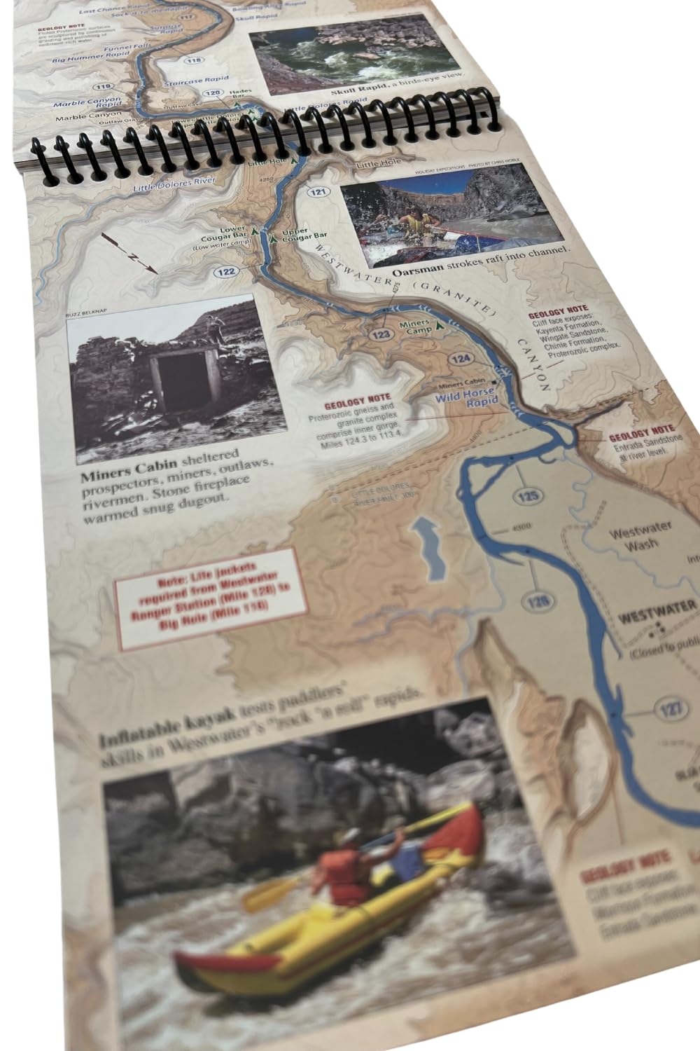
The maps cover the river and mouths of side canyons. You can write on the pages with a Sharpie (let the ink dry for a few seconds or it may smear). There are some annotations showing where some points of interest are and there is good, brief introductory info. For more in depth info on the canyons see the Kelsey guide. The size of the booklet is 8.5 x 5.5 inches closed and 16.5 x 5.5 inches open.
S**E
Not Great but it's about all there is
Since this is the only guide to the Green River we could find, I'm not sure what the point of complaining about it is but it did seem pretty poor. For example, in the entire introduction to the river's history and ecology, it never actually mentions that the river was dammed and what impacts that has had. Bizarre. As a result, it also doesn't give any info on how the flow is regulated or typical seasonal variations. You can check flow history online--we travelled in March when CUF was about 2600 which meant that there was MUD MUD MUD. Campsite selection is critical if you don't want to be waist-deep. The map does not mark campsites--talk to someone in advance to help you out with this. At high water, you will need to know where the high camps are which is a completely different animal. The map does not offer coordinates so you can't usefully use a GPS with it and we found the natural features of the landscape sometimes rather difficult to match to the map. What looks like an incoming "river" on the map is almost non-existent to the paddler so don't count on those as useful landmarks. Next time we will try to mark the map with coordinates ahead of time by using google earth.
S**N
Must have for boating the Colorado or Green River
Great book; the bible for anybody looking to float the Green or Colorado Rivers....a must have in your boat! Waterproof, durable pages are great, but make sure you try out a couple different pens if you want to mark up the pages to see what works best. We used this on a 5 day trip and it's still in great condition and ready for the next outing!
Trustpilot
1 day ago
1 month ago